In this post, we’ll walk you through the options available to create a new project with precision in Bushfire Pro.
Bushfire Pro Support: Let Us Handle It
Need to create a new project quickly and accurately? Simply send us your PDF or CAD file at support [at] bushfirepro [dot] com [dot] au, and we’ll take care of the rest.
We offer an affordable service to help you set up a project from your provided files, allowing you to focus on delivering your project without getting bogged down in technical details.
Do It Yourself with Bushfire Pro’s Tools
If you can’t use the cadastre or any reference point to add your future development, here are some tools that will help you:
1. Using known coordinates
If your future development has specific coordinates, you can use them to accurately draw your site. Otherwise, request the coordinates from your client for the site’s edges, typically in lat/long ( request the coordinates to be provided in EPSG: 4326 (for WA and NSW); MGA Zone 50 for WA, or GDA2020 for NSW).
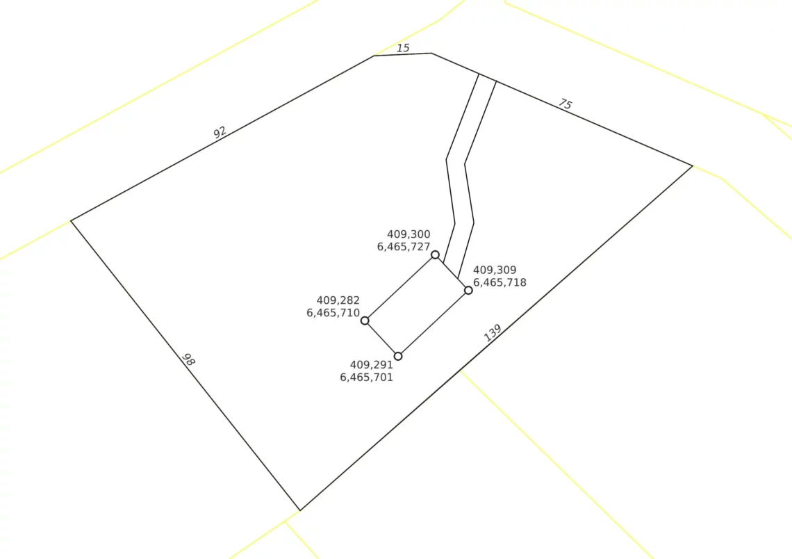
In this example, we’ll use the following coordinates extracted from the drawing:
| Easting | Northing |
| 409,282 | 6,465,710 |
| 409,300 | 6,465,727 |
| 409,309 | 6,46,571 |
| 409,291 | 6,465,701 |
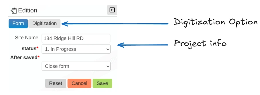
In the Bushfire Pro app, zoom to your area of interest, then navigate to Edit > Subject Land > Add.
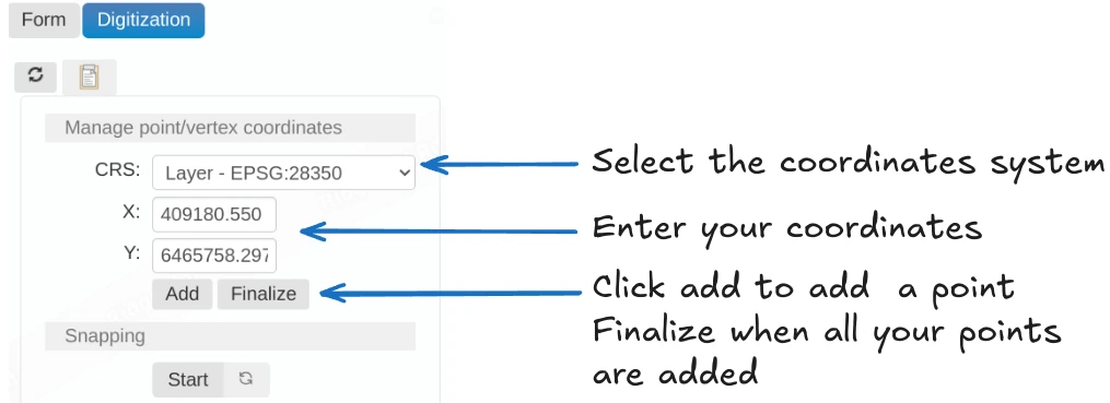
Select the Digitization option, choose the appropriate CRS (Coordinate Reference System), and enter the coordinates. Press Add for each point you need to place on the map, then press Finalize to complete the process. Finally, return to the form and press Save.
2. Measuring Tool
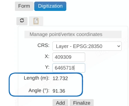
If you don’t have coordinates, you can manually draw your site on the map and use the information in the Digitizing Panel to guide you with segment lengths and angles as you draw.
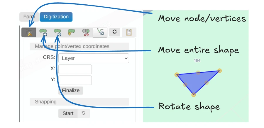
3. Moving, Rotating, and Adjusting Your Drawing
Once you’ve drawn a shape on the map, you can adjust it by:
- Moving the nodes that compose the shape.
- Grabbing and moving the entire shape.
- Rotating the shape.
3. For Advanced Users: Using a GIS Package
If you’re a GIS power user, get in touch and we’ll show you how to integrate Bushfire Pro with QGIS (or other packages).
Digitizing your site directly in QGIS and uploading it to the platform will be just as accurate. Contact us if you’d like to know more about this approach.
Conclusion
We offer multiple options for creating your project—whether you prefer having us handle it or doing it yourself.
We believe practitioners should spend as little time as possible on tasks like drawing subdivisions and instead focus on leveraging their expertise to provide valuable advice.
Let us help you streamline the process, so you can focus on what you do best!
