Bushfire Pro for
Building Surveyors
This powerful tool enhances the way you assess and manage bushfire risk in your construction projects

Building a safer Australia
Achieve far more with less
A cloud-based solution requires less IT support than a desktop application, and is automatically updated every time it’s accessed, so its information is always the latest available.
More maps can be completed in house without requiring external GIS support.
By making changes and printing maps in real-time projects were completed faster allowing more jobs to be undertaken at the same time.
Features
Bushfire Pro requires no specialised training, is quickly accessible via the cloud and easy to use. It offers offers a range of key features designed to streamline your bushfire risk assessment process.
Seamless bushfire risk assessments
Bushfire Pro simplifies the process of assessing Bushfire Attack Levels (BAL). By just entering the site data and environmental factors, Bushfire Pro instantly calculates BAL and Bushfire Hazard Levels (BHL), eliminating the need for manual calculations or extensive GIS knowledge. With this streamlined approach, you can effortlessly comply with the Australian Standard AS 3959, leading to safer, more resilient buildings.
Automated mapping and reporting
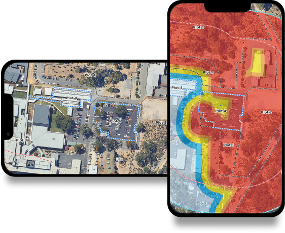
Create high-quality maps with ease using Bushfire Pro. Automated mapping tools allow you to delineate project areas and assessment buffers, draw classified vegetation areas, and see how these factors influence the BAL and BHL. Further, the software allows you to add bushfire mitigation measures directly on the map, providing a clear and comprehensive visual representation of the project site.
Real-time collaboration and sharing
Bushfire Pro’s collaborative features let you share data and project progress in real time with your team.
A cloud-based app means no more wasted time on
back-and-forth communication or misunderstandings about project specifics.
Access on the go
Whether you're in the office, out on site, regardless of device, Bushfire Pro is at your fingertips. With internet connectivity, you can access the app during site visits, enabling you to conduct on-the-spot assessments and make real-time adjustments as necessary.
Efficiency, precision, compliance
Bushfire Pro gives you the tools you need to conduct thorough and accurate bushfire risk assessments, create high-quality maps, and streamline communication with your team. By automating and simplifying these processes, Bushfire Pro helps you save time, improve accuracy, and ensure compliance with regulations and standards.
