At Bushfire Pro, we’re always improving to better support bushfire practitioners. Our new Photo and Reporting Module makes your work easier by streamlining photo uploads, visualizing BAL (Bushfire Attack Level) impacts, and exporting data to Word documents. This lets you quickly copy and paste relevant info into your reports, saving time and ensuring a smooth workflow.
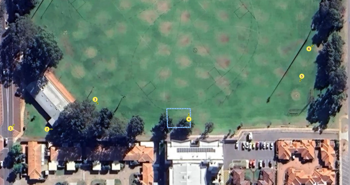
To start with, we took geo-tagged photos in the field with location services on, then renamed them so the app could label them on the map.
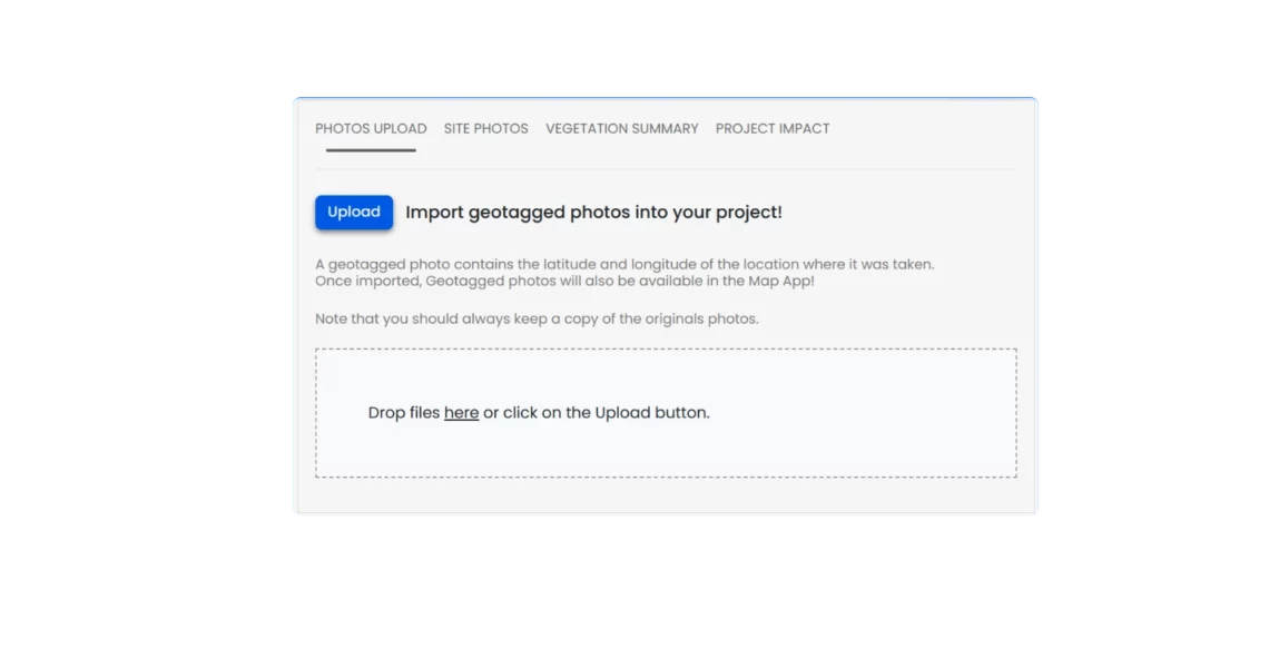
Uploading Photos
The Photo and Reporting Module allows you to view all your projects. Simply click on a project or search for it by name to select it. Once you’re on your project page, click on “Drop Photos Here” and select the photos you want to upload.
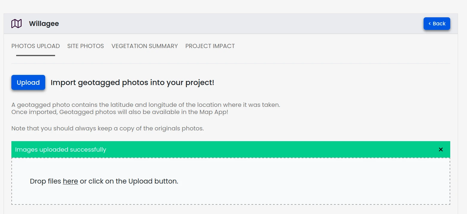
After uploading, the module reads the geo-tagged locations of the photos and loads them directly onto the map!
Notes:
- The GPS accuracy of your mobile device affects the accuracy of the photo locations.
- You can always edit the orientation and position of photo points on the map.
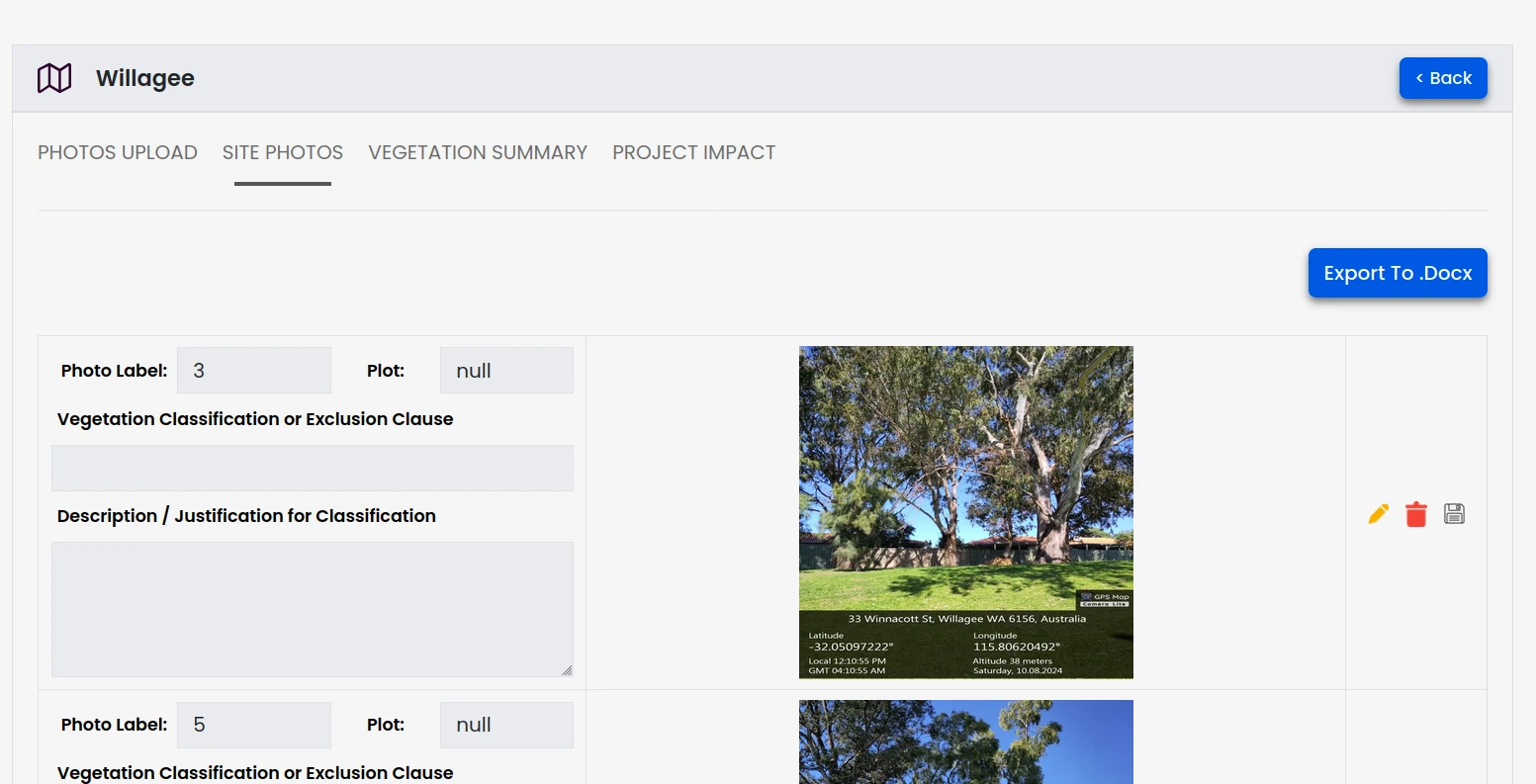
Viewing Your Project Photos
The “Photos” tab allows you to view the uploaded photos and input additional information regarding each photo.
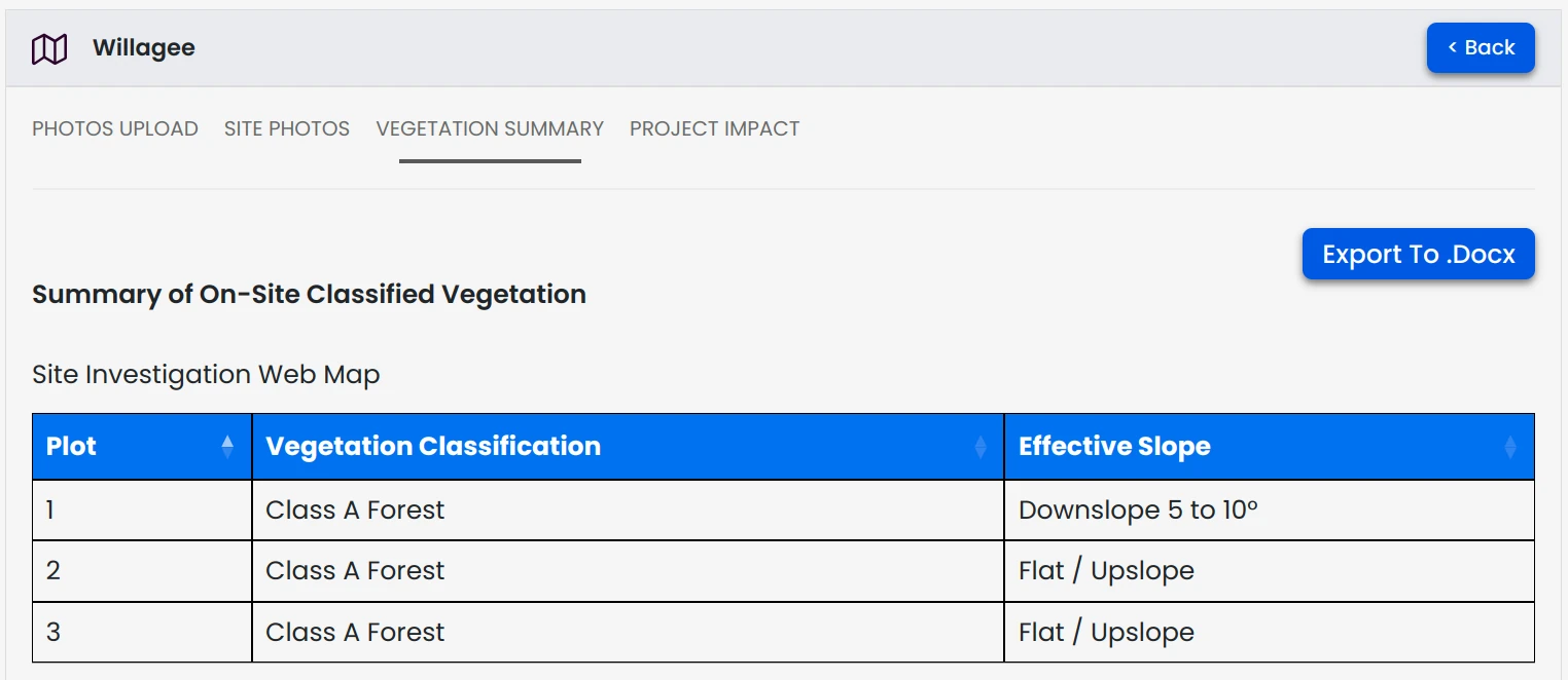
Vegetation Summary
The Vegetation Summary tab lists the project’s classified vegetation, effective slope, and the allocated plot numbers.
Project Impact
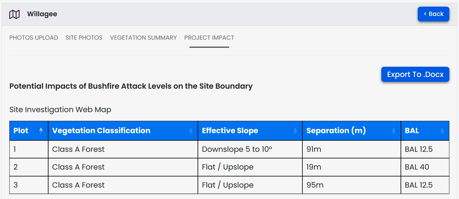
The Project Impact tab helps you assess the distance between vegetation plots and the subject land, showing how each plot influences the BAL rating.
In the image below, Plot 1 is 91 meters from the subject land, generating a BAL impact of 12.5.
Conclusion
With the new Photo and Reporting Module, managing your project photos and reporting is faster and easier than ever. Streamline your workflow, save time, and focus on what matters most—delivering accurate assessments.
