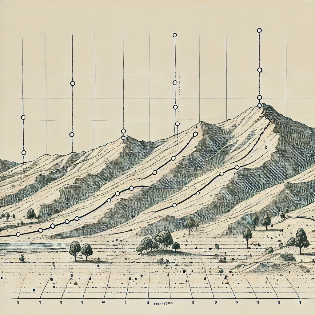
Back Up Your Slope Measurements with Bushfire Pro.
We’re excited to announce a powerful new feature in Bushfire Pro that simplifies slope measurement validation for bushfire practitioners. With the new Elevation Profile Tool, users can now draw a line across any terrain, and the app will automatically generate an elevation profile along that line. This allows practitioners to visually confirm their slope measurements, making it easier to back up their assessments.
As the saying goes, “All models are wrong, but some are useful.” While nothing replaces the accuracy of field measurements, this feature provides practitioners with a valuable resource to support their work. The Elevation Profile Tool is especially useful when accuracy is questioned by regulators, offering a clear, data-driven way to validate slope calculations and ensure compliance with bushfire safety standards.
We’ve also introduced a new Transect layer in the app to clearly mark where the transect has been measured.
Now, let’s explore how the Elevation Profile tool works.
1. Using the Elevation Profile Tool
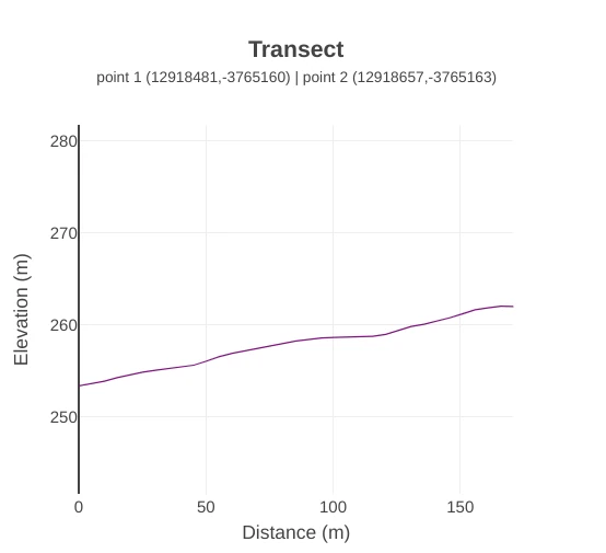
Select the Elevation Profile Tool in the menu, then click on the map to set the start and end points of the transect where the elevation will be measured. The transect line will appear, along with profile slope details such as the average slope, minimum slope, and maximum slope in degrees.
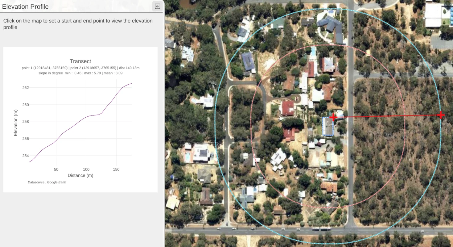
2. Inspecting the Elevation
Once the transect is created, you can further inspect the measured elevations by hovering over the purple line, which will display the altitude.
But that’s not all! The graph is dynamic, allowing you to adjust the units along the x and y axes.
To do this, move your cursor near the y-axis, and you’ll see it change to an up-and-down arrow.
Simply click and slide up or down to adjust the precision, depending on how you’d like to display your elevation profile.
3. Saving and Documenting
Click on the camera icon when hovering over the graph to save it as an image for inclusion in your report.
4. Documenting and Printing Your Transect
The Transect layer is also useful for documentation purposes, as it clearly shows where your elevation profiles were generated. You can draw a transect line, label it, and print a map to include in your report, providing comprehensive visual support for your slope measurements.
Conclusion
We’ve listened to bushfire practitioners and developed the Elevation Profile feature to meet your needs.
Designed by practitioners, for practitioners, this tool makes it easier to validate slope measurements, streamline reporting, and back up your assessments with confidence. With dynamic graphs and a transect layer for clear documentation, Bushfire Pro empowers you to save time and improve accuracy in every assessment.
